|
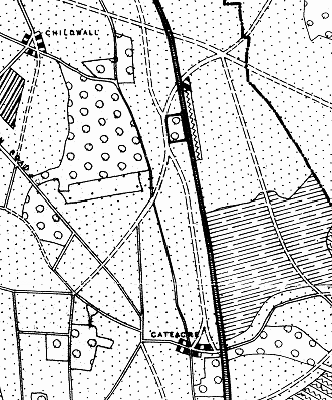
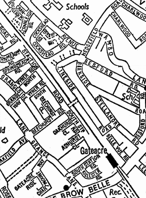
The reason for the name Station Road can be found in the Liverpool Town Planning Scheme No.2, which envisaged it as part of a through route between Broad Green and Halewood. Grange Lane, at that time, was a gated road, badly potholed, having been the subject of a long-standing dispute between the Marquess of Salisbury (as Lord of the Manor of Little Woolton) and the Council. The Town Planning Scheme map published in the 1930s showed a number of new roads, designed to facilitate the development of the district for suburban housing. One of these new roads was what became Gateacre Park Drive. Station Road, if completed according to the plan, would have run all the way from Alderman John Village Gardens to Belle Vale Road, where it would have branched two ways: left to the railway station and right towards the crossroads.
In the event, only part of the new road was built - mainly because Grange Lane had been designated as a through route, and resurfaced, following a court hearing in 1955. The vital link between Station Road and the station in Belle Vale Road was omitted.
A puzzling feature is the name 'South Station Road'. The house numbers in Station Road run from north to south, so there would seem to be no reason why they could not have been continued beyond Beechurst Road (or 'Grange Hill', as it was named on some street maps in the 1950s).
|
|


